When alison kendall’s boss told her in 2007 that her civil service job was being transferred to a different building in another part of Vancouver, she panicked. Commuting to a new office would be no big deal for most people, she knew. But Kendall might well have the worst sense of direction in the world. For as long as she can remember, she has been unable to perform even the simplest navigational tasks. She needed a family member to escort her to and from school right through the end of grade twelve, and is still able to produce only a highly distorted, detail-free sketch map of her own house. After five years of careful training, she had mastered the bus trip to and from her office, but the slightest deviation left her hopelessly lost. When that happened, the forty-three-year-old had to phone her father to come and pick her up, even if she was just a few blocks from home, in the neighbourhood where she had lived most of her life.
Kendall (not her real name) decided to ask a neuropsychologist if she had medical grounds for turning down the transfer. He referred her to a neuro-ophthalmology clinic at the University of British Columbia, where a young post-doc from Italy named Giuseppe Iaria was studying the neuroscience of orientation and navigation. After a battery of tests, Iaria concluded that Kendall was perfectly normal. She had average intelligence, memory, and mental imaging abilities, and her brain was completely undamaged. She was simply unable to form a “cognitive map,” the mind’s way of representing spatial relationships. When he put her in a brain scanner and asked her to explore the streets of a computer-generated virtual town, her hippocampus—the brain region responsible for cognitive maps—remained inactive, even though basic memory tests had shown that it was functional. Earlier this year, a paper by Iaria, neuro-ophthalmologist Jason Barton, and their colleagues appeared in the journal Neuropsychologia, describing a new disorder called “developmental topographical disorientation,” or dtd. Kendall was “Patient 1.”
Like any other human trait, navigational skill varies widely—some people crow about their abilities, while others lament their ineptitude. So in a way, Kendall’s condition came as no surprise. (“I was expecting to find someone like that eventually,” Iaria says.) But the brain’s navigational wiring doesn’t just reflect our talent at getting from A to B; it also reflects the ways in which we perceive and interact with the world around us. As our surroundings have evolved over the centuries, so too have our navigational strategies and conceptions, shaped most recently by urbanization and the advent of high-speed travel.
We’re now on the cusp of an even more dramatic change, as we enter the age of the global positioning system, which is well on its way to being a standard feature in every car and on every cellphone. At the same time, neuroscientists are starting to uncover a two-way street: our brains determine how we navigate, but our navigational efforts also shape our brains. The experts are picking up some worrying signs about the changes that will occur as we grow accustomed to the brain-free navigation of the gps era. Once we lose the habit of forming cognitive maps, we may find ourselves becoming more and more like Patient 1.
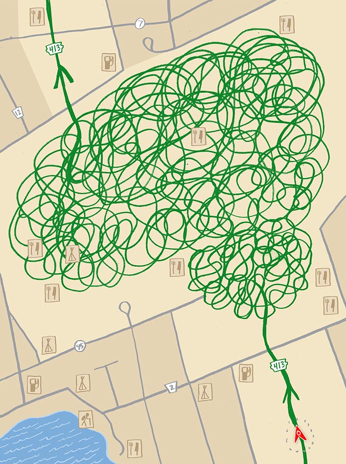
It was the flower shop that messed me up. I was navigating through the virtual town Iaria had built within a video game platform, trying to learn the locations of four landmarks: a Wendy’s, a Days Inn, a flower shop, and a movie theatre showing Hugh Grant’s Love Actually. It took me three tries to place all of them in the correct positions on a map; typical scores range from two to five. “You’re average,” Iaria (who has since taken a faculty position at the University of Calgary) said cheerfully, crushing my hopes of being a super-outlier. That morning, as I’d walked the three kilometres from my downtown hotel to Vancouver General Hospital, I’d oriented myself by marking the cues provided by an unfamiliar city: glancing at a few key street names I’d jotted on a piece of paper; keeping the mountains on my left once I’d crossed the Granville Street Bridge; and more or less ignoring the shorelines, which seemed to point in different directions every time I looked at the water.
Iaria and McGill University researcher Véronique Bohbot demonstrated in a widely cited 2003 study that our mapping strategies fall into two basic categories. One is a spatial strategy that involves learning the relationships between various landmarks—creating a cognitive map in your head, in other words, that shows where the flower shop and other destinations sit on the street grid. The other is a stimulus-response approach that encodes specific routes by memorizing a series of cues, as in: get off the bus when you see the glass skyscraper, then walk toward the big park. For their study, Iaria and Bohbot created a virtual maze that tested both methods; they found that about half of us prefer spatial strategies, while the other half prefer stimulus-response.
Most of us can use both, depending on the circumstances, but we have a bias toward one or the other. (Kendall was relying solely on cues, in the absence of cognitive mapping skills.) Stimulus-response navigators tend to complete the task more quickly and make fewer errors. “Cognitive mapping is difficult, it’s complicated, it’s tedious,” Bohbot says. The spatial approach does have one major advantage, though: versatility. If I memorize the routes from the flower shop to the movie theatre, and from the movie theatre to the Wendy’s, I can whip back and forth along those routes very quickly. But what if I want to go from the flower shop straight to the Wendy’s? Without a cognitive map, I have no way of figuring out shortcuts or exploring new routes to different destinations. I can only go where my stimulus-driven mind has already left a trail of bread crumbs.
The idea that we carry maps in our heads is relatively new. An experimental psychologist at the University of California, Berkeley, Edward C. Tolman, coined the term “cognitive map” in a 1948 paper showing that rats in certain types of mazes were able to figure out shortcuts to a destination—a clear sign that they weren’t simply learning a sequence of left and right turns. Amazingly, a series of experiments in the 1970s suggested that cognitive maps are more than metaphorical. Certain neurons in the hippocampus, called “place cells,” were observed activating only when the rat was in a specific place. Let the animal wander through a maze, and you could watch a chain of neurons fire in a spatial pattern that exactly matched its path, at a smaller scale.
Whether the same picture can be extended to humans remains a matter of considerable controversy. We don’t know whether the firing patterns of neurons in our hippocampus would trace out the patterns of our neighbourhood, because researchers aren’t allowed to implant arrays of electrodes in our brains. We do know, though, that the human hippocampus stores the same kind of information as the rat hippocampus does, thanks in part to a remarkable series of experiments on a group of truly gifted navigators.
For those of us who have grown up in the reassuring embrace of grid-patterned streets that run straight and don’t change names every two blocks, Old World cities like London—recently declared the most confusing city in the world by a 12,500-person Nokia Maps survey—present huge challenges. So pity the cabbies. Before getting behind the wheel of a black cab, would-be drivers have to pass a test called the Knowledge, which requires them to memorize some 25,000 streets and thousands of landmarks, a task that takes two to four years.
A cognitive map featuring that level of detail, as you might imagine, requires a fair amount of storage space, and, sure enough, University College London neuroscientist Eleanor Maguire found that the back part of the hippocampus in London taxi drivers is enlarged compared with that of the general population. The longer they’ve been driving, the bigger the gap. Maguire also found, though, that the front part of the hippocampus gets correspondingly smaller. “So there is a price to pay for their expertise,” she says. This difference showed up in tests of visuo-spatial memory, including one in which the drivers were asked to memorize the position of sixteen objects on a table, then put them back in place after they’d been removed. “They were incredibly poor at doing that,” she says. While it isn’t yet clear whether this happens because the requirements of storing a map of London take over other parts of the brain or because of some other process, what these studies do make clear is the brain’s plasticity: its very structure is shaped by the demands we place on it.
It follows, then, that the shape of our hippocampus, and the organization of our brain, must depend on when and where we’ve lived. If a few years in a taxi can produce noticeable differences in our brains, imagine what a lifetime of roaming the featureless Arctic or sailing between remote Polynesian islands would do. Similarly, determining whether someone like Alison Kendall has a genuine disorder, or simply lies at the extreme edge of a normal range of navigational skill, is not straightforward. “If you hear her story, you think, ‘That’s really out there,’” says Jason Barton. “But there’s variation in every human ability, and this, I’m sure, is one of them.”
Since Kendall’s story was published, 450 more people have contacted Iaria. About fifty of them display some signs of brain damage, but the other 400 share three key characteristics. “First, they have no other neurological conditions. They function normally, in a range of jobs,” he says. “Second, they get lost every day. And third, they’ve been getting lost since they were children.” Over the summer, he posted nine tests on a website called gettinglost.ca. They are designed to test orientation, spatial memory, and a series of other cognitive skills. The goal is to identify more dtd sufferers, and eventually to bring them in and run more detailed tests to find out what they have in common. But he also wants people with normal navigation skills to take the tests—as many as possible. “If you do a study with ten, twenty, fifty subjects, you make kind of a speculation,” he says. “If you have 50,000, there’s no variability that can affect your data.”
That number isn’t as far fetched as it sounds. Researchers studying face blindness, a cognitive condition with key similarities to dtd, managed to get some 60,000 people to take their online tests. A data set that large would allow Iaria to get a snapshot of what is normal for the population as a whole, along with insight into how navigational abilities depend on factors like age and gender. Mind you, this approach does have one significant blind spot: if something is altering the navigational skills of the entire population, it won’t be detected.
In June, Al Byrd’s three-bedroom home, built by his father on the western outskirts of Atlanta, was mistakenly torn down by a demolition company. “I said, ‘Don’t you have an address? ’” a distraught Byrd later recounted. “He said, ‘Yes, my gps coordinates led me right to this address here.’” The incident joined a long list of satellite-guided blunders, including one last year in which a driver in Bedford Hills, New York, obeyed instructions from his gps to turn right onto a set of train tracks, where he got stuck and had to abandon his car to a collision with a commuter train. Incredibly, the same thing happened to someone else at exactly the same intersection nine months later. In Europe, narrow village roads and country lanes have turned into deadly traps for truckers blindly following gps instructions, and an insurance company survey found that 300,000 British drivers have either crashed or nearly crashed because of the systems.
More subtly, the increase in gps use has meant that people spend less time learning details about their neighbourhoods. British researchers testing cognitive map formation in drivers found that those using gps formed less detailed and accurate maps of their routes than those using paper maps. Similarly, a University of Tokyo study found that pedestrians using gps-enabled cellphones had a harder time figuring out where they were and where they had come from. Their navigational aids, in other words, had allowed them to turn off their hippocampi.
To many, the beauty of the devices is precisely that we no longer have any need to painstakingly assemble those cognitive maps. But Cornell University human-computer interaction researcher Gilly Leshed argues that knowledge of an area means more than just finding your way around. Navigation underlies the transformation of an abstract “space” to a “place” that has meaning and value to an individual. For the gps users Leshed and her colleagues observed in an ethnographic study, the virtual world on the screens of their devices seemed to blur and sometimes take over from the real world that whizzed by outside. “Instead of experiencing physical locations, you end up with a more abstract representation of the world,” she says.
On a snowmobile trip of over 500 kilometres across the Arctic, this blurring of the real and the virtual became obvious to Carleton University anthropologist Claudio Aporta. Returning from Repulse Bay to Igloolik, a village west of Baffin Island where he was conducting fieldwork, he and an Inuit hunter became engulfed in fog. The hunter had been leading the way along traditional routes, guided by the winds, water currents, animal behaviour, and features such as the uqalurait, snowdrifts shaped by prevailing winds from the west by northwest. Like London taxi drivers, Inuit hunters spend years acquiring the knowledge needed to find their way in their environment, part of a culture in which “the idea of being lost or unable to find one’s way is without basis in experience, language, or understanding—that is, until recently,” as Aporta and Eric Higgs wrote in a 2005 paper on “satellite culture” and the rise of gps use in Igloolik.
Heavy fog is the one condition that stymies even the most expert Inuit navigators. The traditional response is to wait until the fog lifts, but, knowing that Aporta had mapped the outbound journey on his gps, his guide asked him to lead the way on his snowmobile. “It was an incredible experience, because I could see absolutely nothing,” he recalls. “I didn’t know if there was a cliff ahead; I was just following the gps track for five kilometres, blind, really.” This was the extreme version of the city driver blankly turning left and right at the command of his gps, and it required a leap of faith. “Believe me,” he says, chuckling, “I was sweating like crazy.”
The demonstrable benefits of gps have, however, removed much of the incentive for the younger generation in Igloolik to undertake the arduous process of learning traditional navigation techniques. Elders worry about this loss of knowledge, for reasons that go beyond the cultural—a straight line across an empty icefield plotted by gps doesn’t warn about the thin ice traditional trails would have skirted. Dead batteries and frozen screens, both common occurrences in the harsh Arctic conditions, would also be disastrous for anyone guided solely by technology.
Aporta notes, though, that gps is just one element of an “ecology of technologies” in Inuit life, stretching back to the rifle and the snowmobile, and encompassing even broader trends like the establishment of permanent settlements. “It’s also the first technology in the history of navigation that gives you an answer to a spatial question without you needing to be engaged at all,” he says. The net result is an increasing disconnection for young Inuit from the rhythms of their environment. And though the stakes are high in the harsh conditions of the Arctic, similar changes are taking place everywhere. “I like to ask my students questions about the Rideau River, which is right here,” he says, gesturing to a window overlooking the Carleton campus. “Where is the river flowing? How did people use it before? And people born in Ottawa have really struggled to give me environmental information about a feature they see on a daily basis.”
Across the hall from Véronique Bohbot’s tiny office on the ground floor of Douglas Hospital, on the south shore of the island of Montreal, a mock mri machine is set up, complete with a glass-panelled control room and an electric platform that slides the patient into a cylindrical imaging chamber at the touch of a button. Here, experimental subjects practise navigating through a virtual maze on a screen they can only see through a series of mirrors. They must learn to keep their heads perfectly immobile in order for Bohbot to be able to peer inside their brains once they’ve graduated to the “functional” mri machine off-site. fmri tracks the flow of blood to different parts of the brain, allowing near-real-time monitoring of which areas light up during different tasks. Iaria and Bohbot used the technology to confirm that spatial navigators use the hippocampus, while stimulus-response learners use another region of the brain called the caudate nucleus.
Another mri technique called “voxel-based morphometry” maps brains of different sizes onto a standard template, so the relative size of their subunits can be compared. In 2007, as a follow-up to the first study, Bohbot and her collaborators showed that the half of the population that prefer to use spatial strategies have bigger hippocampi, while the half that prefer stimulus-response navigation have bigger caudate nuclei—a predictable result, given the plasticity demonstrated by London taxi drivers. But that leaves an unresolved chicken-and-egg question: does using spatial strategies make your hippocampus bigger, or does having a bigger hippocampus make you more inclined to use spatial strategies?
To probe more deeply, Bohbot teamed with Jason Lerch, a researcher at the mouse imaging centre at Toronto’s Hospital for Sick Children. He trained a group of mice on a standard challenge called the Morris water maze, tweaking it so half the mice were forced to use spatial strategy and the other half stimulusresponse. “Lo and behold, after only five days of training he scanned them on a seven-tesla mri and found grey matter differences in the hippocampus and caudate nucleus,” Bohbot says, “just like we did in humans.” Then they dissected the brains (a luxury they don’t have with human subjects) and found that the increased volume came from “dendritic arborization”—an increase in the number of connections to and from each neuron. “Instead of having a skimpy tree with one branch,” she says, “it’s going to have a dozen branches.”
Though the data can only be extrapolated so far, Lerch’s mouse studies suggest that human brains begin to reorganize very quickly in response to the way we use them. The implications of this concern Bohbot. She fears that overreliance on gps, which demands a hyper-pure form of stimulus-response behaviour, will result in our using the spatial capabilities of the hippocampus less, and that it will in turn get smaller. Other studies have tied atrophy of the hippocampus to increased risk of dementia. “We can only draw an inference,” Bohbot acknowledges. “But there’s a logical conclusion that people could increase their risk of atrophy if they stop paying attention to where they are and where they go.”
Of course, we do still navigate the local environments where we spend most of our time—our homes, our offices, our immediate neighbourhoods—without gps, so a change in brain structure is perhaps unlikely. And we also use the hippocampus to store autobiographical memories and to imagine the future. But Bohbot sees the decline in spatial thinking as part of a broader shift toward stimulus-response, reward-linked behaviour. The demand for instant gratification, for efficiency at all costs and productivity as the only measure of value—these sound like the laments of the nostalgist in the Age of the Caudate Nucleus. But here, they’re based on neuroscience. “Society is geared in many ways toward shrinking the hippocampus,” she says. “In the next twenty years, I think we’re going to see dementia occurring earlier and earlier.”
This was the point at which I started feeling guilty for giving my parents a gps system for Christmas last year. But of course gps has many positives. For patients suffering from disorders like Alison Kendall’s, satellite navigation has provided a crucial lifeline. Among the Inuit, gps is helping to map and preserve traditional routes, and the technology is actually spurring interest in navigational heritage among younger people. Cornell’s Gilly Leshed, too, saw benefits in her ethnographic study of gps users. Those with a poor sense of direction were able to explore more freely and were more likely to venture to new places, since directions home were always available at the press of a button. “Still, it doesn’t force them to be attuned to their environment,” she admits. “They’re freed, but they’re not challenged.” Leshed and others hope gps will eventually be designed so as to spur engagement with the landscape without sacrificing convenience—for instance by pointing to landmarks (“Turn left after the gas station”) rather than location-agnostic instructions (“Turn left in three blocks”).
When I was a kid, I had an old Mad magazine from the 1960s that bemoaned the advent of the electric scooter and predicted that by the end of the century North Americans would look like oversized bowling pins with tiny, vestigial legs, ripe for knocking over by lean Communist invaders. Rather than forgetting how to walk, however, 4.5 million Canadians now pay to join health clubs where they can spin their legs on treadmills and exercise bikes to make up the miles they no longer travel in their daily lives. Many others choose to forsake “efficiency” by biking to work or walking to the supermarket, because they’ve realized that letting technology do too much leaves their bodies worse off. We may soon take the same approach with our brains.
In her basement lab in Montreal, Bohbot gave me a foretaste of the spatial memory training program she and her students have been developing for the past four years. Donning the requisite 3-D glasses, I navigated around an eerily accurate virtual version of the Douglas Hospital campus, projected onto an enormous three-metre-wide screen that divided the otherwise uniformly black room in two. Bohbot’s group has created forty-six different virtual environments, each designed to force people to employ spatial memory rather than stimulus-response strategies. The proposed structure is an eight-week, sixteen-hour program featuring exercises that can run on a typical computer screen—though Bohbot isn’t sure how successful an at-home program would be. “It’s boring!” she admits. “And really, we have to be there administering it and telling people it’s supposed to be hard.”
For Kendall’s part, she was able, after six weeks of working with Iaria for an hour a week, to shorten the time she needed to form a cognitive map in a simple virtual environment from thirty-two minutes to five. Her success offered further evidence that her inability to form cognitive maps isn’t the result of hidden brain damage. She can do it; she’s just very bad at it. The precise combination of genetic and environmental factors responsible for this shortcoming remains unclear, but the results of her training are heartening. They suggest that, as with any cognitive task, we may differ in our natural endowments, but we can always improve.
Of course, they also suggest that we can decline, and that’s why Iaria, too, has reservations about gps. “It’s an amazing tool, and I’m so grateful we have this kind of technology for people that need it,” he says. “At the same time, I don’t think it’s a tool that we may want to use every day for fun. Because then you don’t think about your environment, you don’t look at it, you don’t care about it.” He often encounters people who believe they have terrible navigation skills but who turn out to perform perfectly well on his tests. It may be, for example, that their spouses always drive, so they have no reason to pay attention to their routes and consequently never know where they are. That’s an attention problem, not a navigation problem.
Iaria himself, after years of studying the vagaries of human navigation, has become a good man to have at your side on a trip to points unknown. When he encounters new places, he knows which features to seek out to get oriented. He’ll find the tallest building or landmark, and remember what it looks like from different perspectives. And he can give people good directions in whatever navigational language they happen to speak, whether by referring to landmarks, compass directions, distances, or street names. But that doesn’t mean finding his bearings is an obsession. “You know, I lived in Paris, and to me one of the most beautiful things was just getting lost sometimes in these very small streets, and having a coffee and a cigarette with strangers, and going back trying to find your way,” he says. “These days, there are very few moments you actually have the freedom to get lost.”
Alex Hutchinson received a Canadian Institutes of Health Research Journalism Award to support his research into the neuroscience of navigation.